Version 8 | Release Notes
VERSION 8.0.2.0
26th November 2019
NEW USER EXPERIENCE
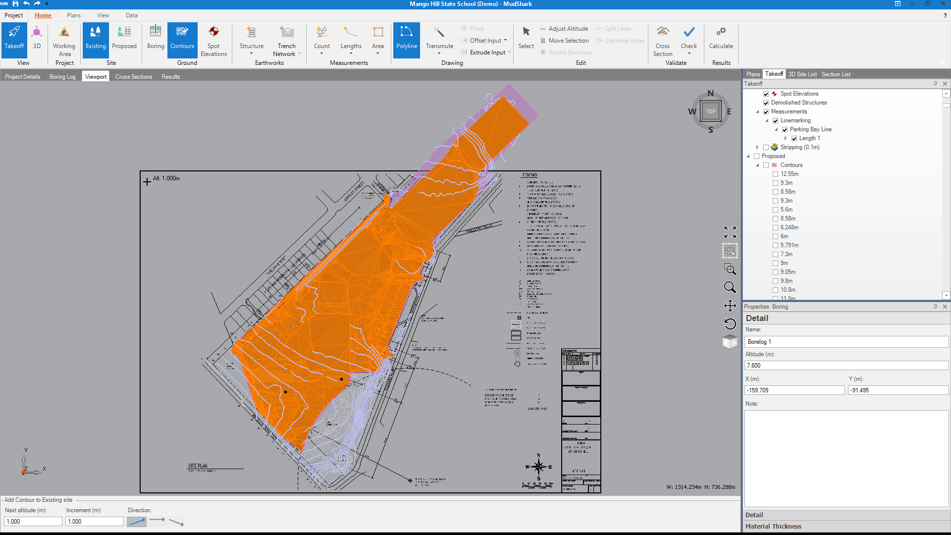
We’ve made MudShark easier to use, not only for new customers; but also existing ones. We’ve kept the same workflow that all our customers have told us they liked but implemented a new skin, new icons and a new Data tab, among other changes.
Updated Ribbon
We’ve spent time updating MudShark’s look, so it’s easier to use. We’ve decluttered the ribbon and introduced simpler icons to better represent the various features and tools. Now, the selected options from the ribbon will show as white on a blue background, so it’s even clearer what stage of the takeoff you’re at or what tools you have selected. We’ve also added new tooltips, and improved many of our existing ones so more clearly explain what everything in MudShark does.
Data Tab
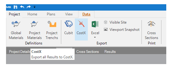
The new Data tab is the place to go to output your results or measurements for Microsoft Excel or to integrate your results for estimating costs. You’ll also find your Material Definitions here, and you can export your Visible Site to 3D or just a snapshot of your VIewport.
Improved Interface
We raised the pane tabs, so you can more easily change between Plans, Takeoff, 3D Site List and Section List panes. We paid special attention to the Calculate and Rescale windows, improving the layout and the details. We also updated the field names for the Project Manager, to include City, Town, and Zipcode, for our international customers.

ESTIMATING SOFTWARE INTEGRATION
We've made it easier to export your takeoff data for estimating, with one click you can export your results for Cubit or CostX.
When you click CostX, you will now create a RIB file with your groundworks data, so you can more easily utilise the power of CostX.

TAKEOFF PERFORMANCE IMPROVEMENTS
We’ve improved many interactions in the viewport, especially when performing takeoff for a larger project.
Specific improvements include:
- Changing between Takeoff and 3D
- Changing Sites (between Existing and Proposed)
- Adding Spots
- Adding Contours
- Adding and editing boundaries
We’ve also improved Transmute Area; to find a wider range of areas.
MudShark will calculate areas for striping and respread when you click Calculate instead of when you perform your takeoff, so you can get through your work faster.
Improved Transmute Dashed Line
We’ve improved how Transmute Dashed Lines handles contours where the only gap in the line was to display the value of that contour.
We’ve refined our algorithm, so now Transmute Dashed Lines will better handle larger gaps between lines, and automatically find more of a specific line with less input required.
ADDITIONAL IMPROVEMENTS
- Improved automatic scaling of DWG files for projects using imperial units.
- Improved how MudShark reads PDFs, so there is an increase when using PDF plans and better layer information means the tools will work easier.
- Improved the DWG Exporter to conform to the updated Autodesk format principles.
- Improved how you enter Boring Logs, so if you enter one or more boring point without creating a Boring List first, each log will use the altitude from your contours or spots.
- Improved how Respread works, so now Open Ground Fill will automatically be selected when Respread is checked.
FIXES
- Fixed a rare issue where sometimes undoing a boundary created with Transmute would display an error message and require restarting the software.
- Fixed a rare issue where the labels for Elevations were not displaying as intended, sometimes when the display option was checked elevations were hidden; when the display option was unchecked they were shown.
- Fixed an issue where Heat Maps were not calculating for demolished structures correctly.
- Fixed a rare issue where some DWG files where displaying arcs and some text incorrectly.
- Fixed a rare issue where Existing Site structures with Overlay options applied were not always calculating correctly.
- Fixed an issue where sometimes you couldn’t progress with Transmute Dashed Lines if your endpoint was too close to your starting point.
- Fixed a rare issue where if you transmuted tins with quads, you might be able to edit the points in the DWG file data.
- Fixed an issue where if you used Transmute Dashed Lines and right-clicked to complete the line without entering a starting point, a warning message would be displayed and you would have to restart MudShark.
- Fixed an issue when creating Lengths, Areas, or Counts, was sometimes mislabelling their results with incorrect default labels.
- Fixed an issue where the Offset and Extrude windows would appear even if you didn’t enter or select a line to use.
